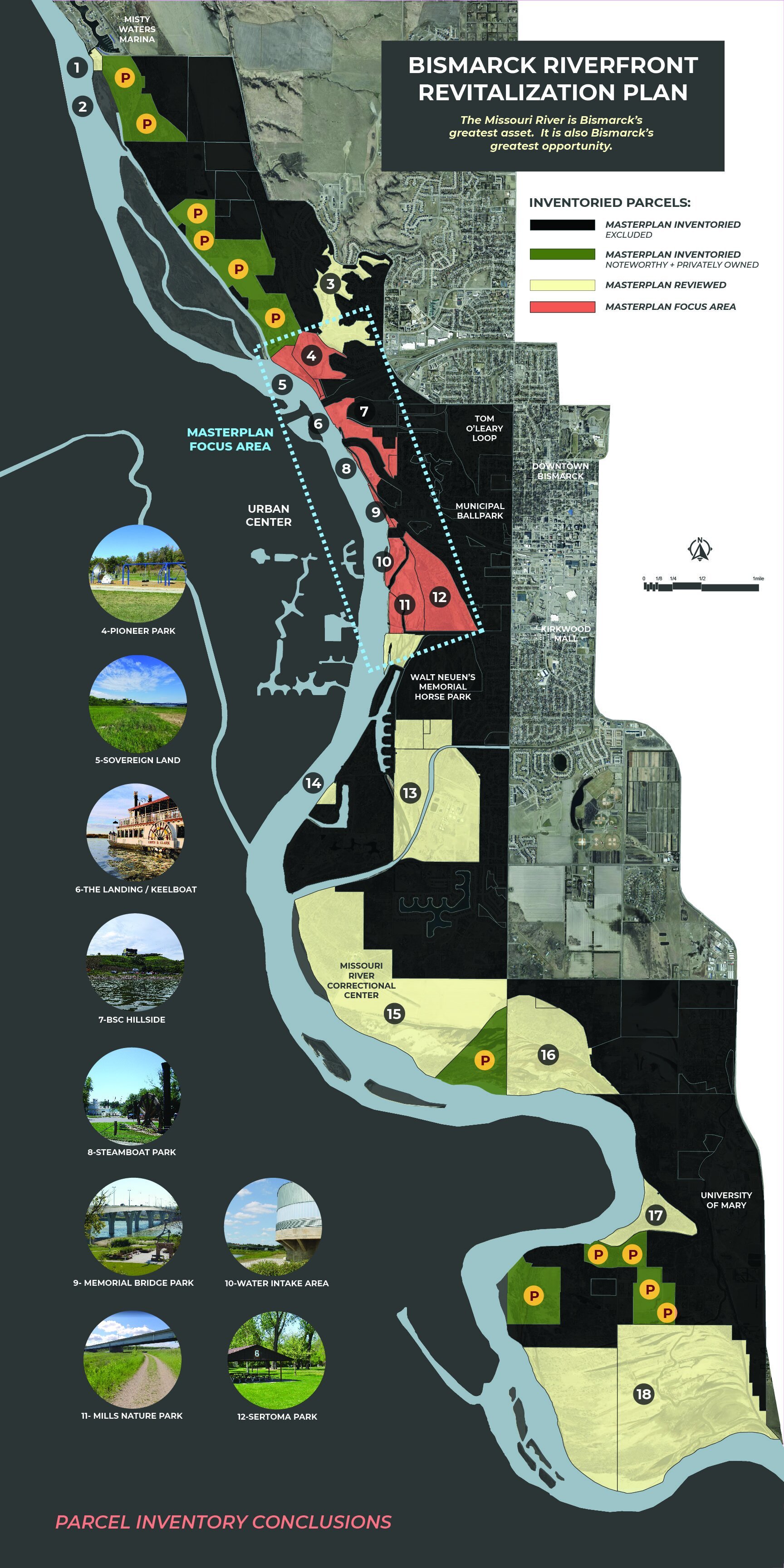
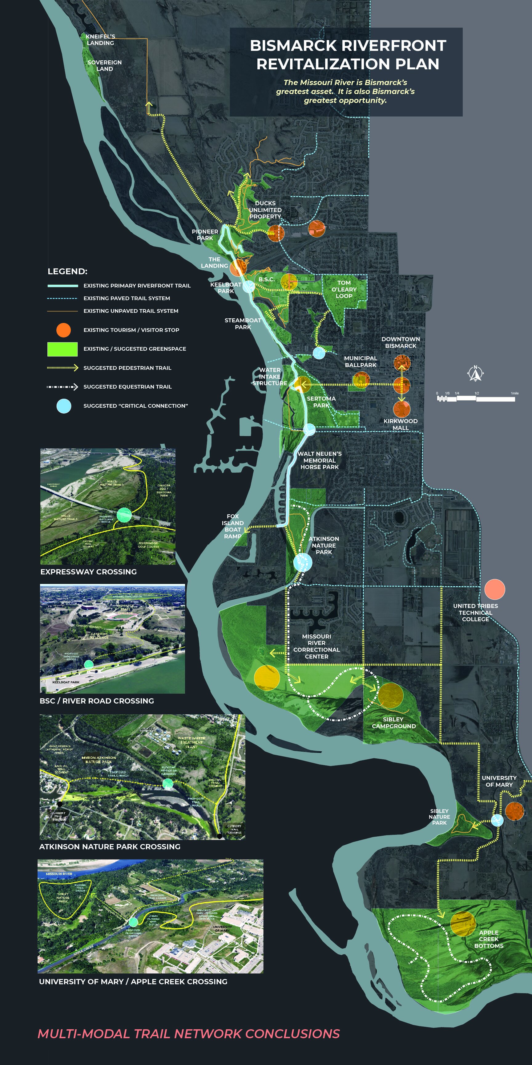
The Bismarck Riverfront Idea - The Study Area
The study area for this project includes a 19 mile stretch of riverfront beginning at Misty Waters to the north and ending at the Heart River confluence to the south, near the University of Mary. The Missouri River is a shared resource between the cities of Bismarck and Mandan. Unfortunately, only the Bismarck side of the river was reviewed at this time due to budget restrictions. Future planning efforts revolving around the Missouri River would benefit from input from both communities to create a cohesive riverfront.

Research and Analysis
The consultant team generated an inventory of existing conditions over the course of six months. The study area was explored by foot, by boat, and through the use of motorized scooters available in the community. Mapping tools and software, such as GIS, were also used to explore the existing conditions. The resultant inventory information was shared with stakeholder groups for reaction and feedback. Inventory collected included:
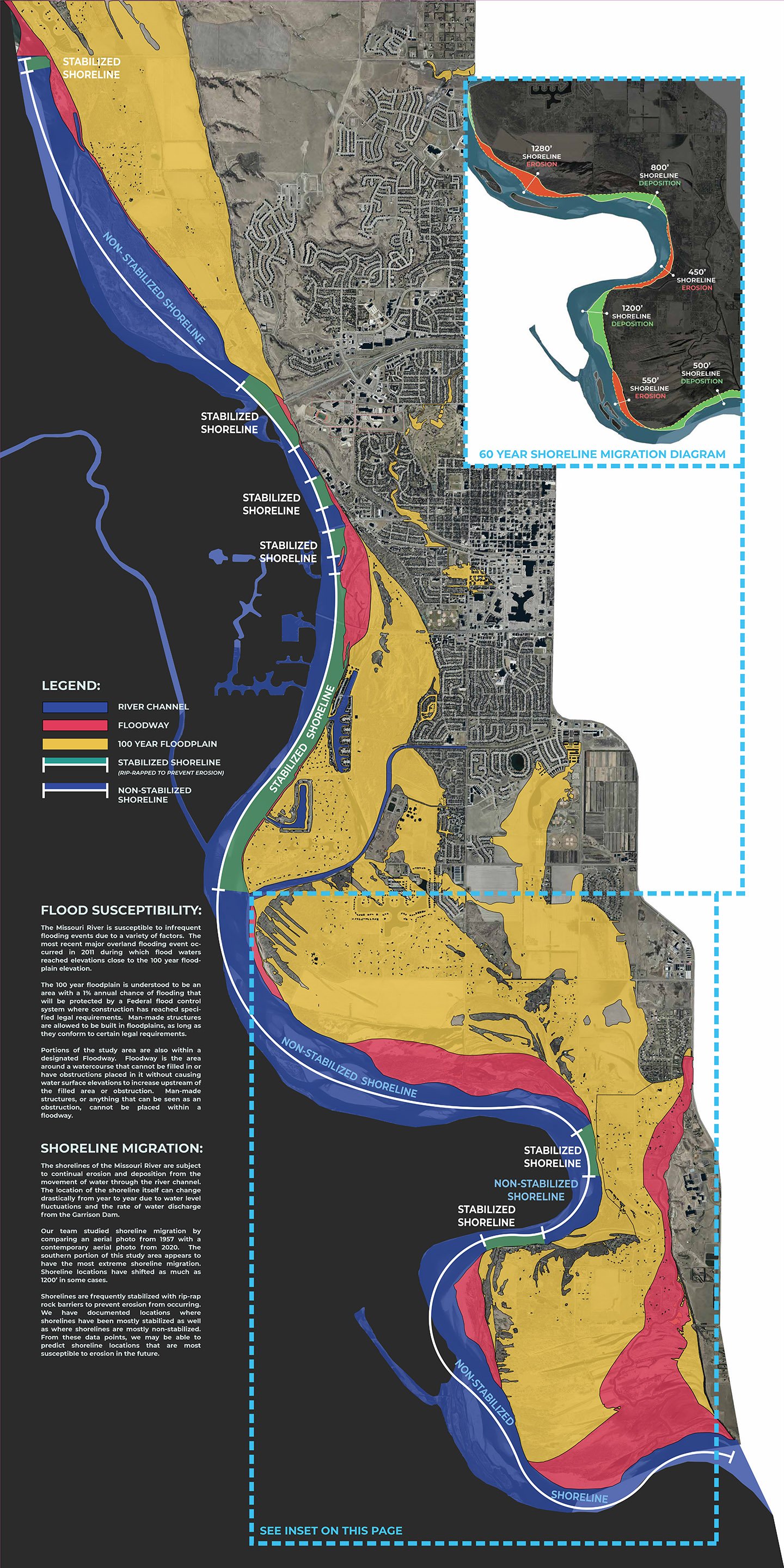
flood susceptibility, bank stability, and shoreline migration patterns
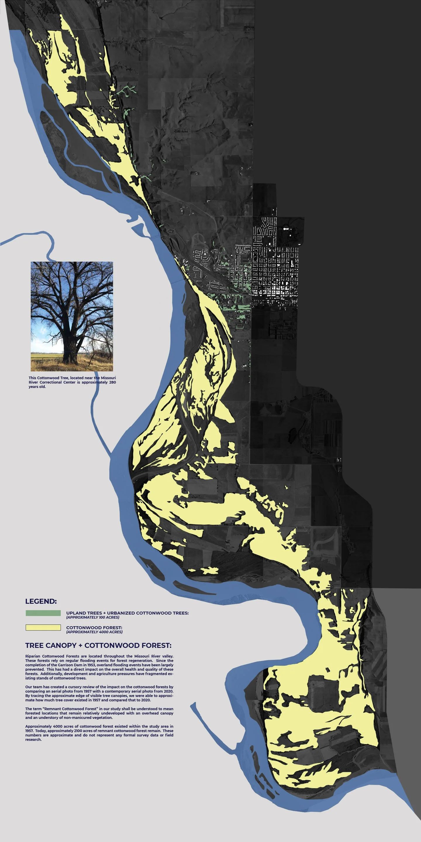
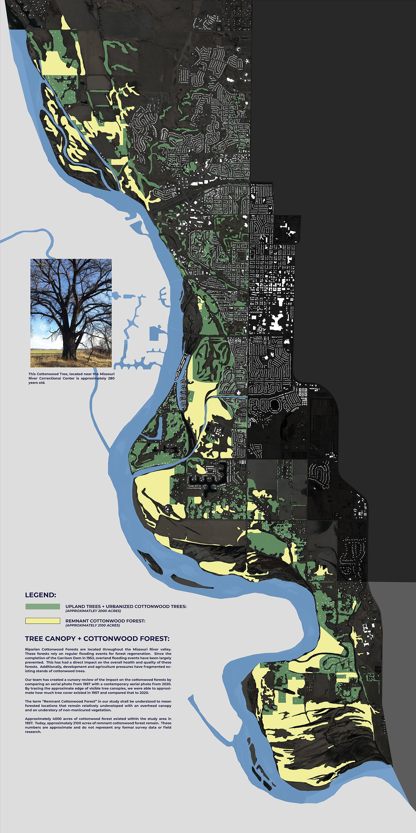
historic and current cottonwood forest cover
ownership interests
commercial uses and tourism interests
trail systems and linkages
boat ramp access (motorized and non)
watercraft trail networks (primary kayak routes)
shoreline privatized versus public access


Market Comparison
Market analysis was performed comparing Bismarck’s riverfront offerings to those of similar riverfront communities throughout the country. Communities identified as providing the greatest competition to Bismarck for primary sector job growth and talent attraction / retention were explored as part of this analysis. The results are provided in the spreadsheet below. A list of amenities is provided along the left side and the peer communities are identified along the top row. The darker the intersecting box color is, the more developed the riverfront amenity is. A total score is provided along the bottom row.


River Greenway - Sioux Falls, SD

Bluestem Amphitheatre - Moorhead, MN
Smothers Park - Owensboro, KY
Final Takeaways:
There are 19 boat ramps within a 20 mile radius of Bismarck.
62% of the shoreline within the study area is not accessible to the general public as it is either privately owned or publicly owned with access restrictions.
The riverfront trail system from Southport Marina to Pioneer Park is the most heavily trafficked trail stretch in Bismarck.
Since the construction of the Garrison Dam in 1957, approximately 48% of the cottonwood forest within the study area has been urbanized or removed.
Stretches of shoreline within the study area have eroded inward or migrated outward as much as 1200’ within the last 60 years.
Tourism brings 22 million visitors to the state each year contributing $3 billion in visitor spending to the state’s economy.
The Missouri River is central to the Northern Plains National Heritage Area and 36 natural, cultural, historic and scenic points of interest.
